


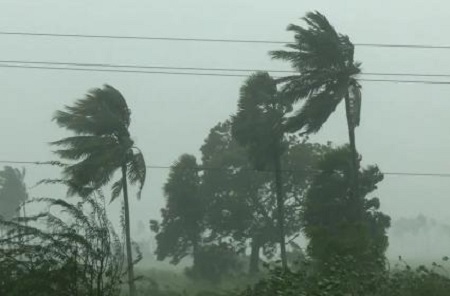
Cyclone Murasu made landfall along the south Andhra Pradesh coast early Tuesday, bringing strong winds and the threat of intense rainfall across several parts of southern and central India. The cyclone crossed the coastline between Nellore and Narasapur, close to Ongole, with sustained wind speeds of 100–110 kilometres per hour and gusts reaching 120 kilometres per hour. The India Meteorological Department (IMD) has warned of heavy to very heavy rainfall, including isolated extremely heavy downpours, over Andhra Pradesh and Telangana. As the weather system moves further inland and gradually loses intensity, several other states are also expected to experience heavy rain, thunderstorms and gusty winds.
Cyclone Murasu, which developed over the West Central Bay of Bengal, crossed the south Andhra Pradesh coast early Tuesday between Nellore and Narasapur, near Ongole. At the time of landfall, the system generated wind speeds of 100–110 kilometres per hour, with gusts reaching up to 120 kilometres per hour, making it a significant weather event for the coastal region.
According to the IMD, the cyclone is currently centred over South Coastal Andhra Pradesh. It is expected to continue moving in a north-northwestward direction while gradually losing strength. The weather department has forecast that the system will weaken into a cyclonic storm by noon and further deteriorate into a deep depression by midnight.
Although the cyclone is expected to weaken, its associated rain-bearing clouds are likely to produce widespread precipitation across several regions. The IMD has issued a red colour warning for Andhra Pradesh and Telangana, forecasting heavy to very heavy rainfall with isolated extremely heavy rainfall on Tuesday. The warning indicates the possibility of intense weather conditions that could disrupt normal life, particularly in vulnerable areas.
The impact of the system is not expected to remain confined to Andhra Pradesh and Telangana. Heavy rainfall has also been forecast over Chhattisgarh, Odisha, South Interior Karnataka, Coastal Karnataka, Kerala, Mahe, Tamil Nadu, Puducherry and Karaikal.
The IMD has further predicted thunderstorms accompanied by lightning and gusty winds over Konkan, Goa, Madhya Maharashtra, Lakshadweep, Madhya Pradesh and Vidarbha. The extensive geographical spread of the forecast highlights the influence of the cyclone's circulation and associated atmospheric conditions over a large part of the country.
The weakening of Murasu after landfall does not necessarily mean an immediate end to the weather-related risks. Even as wind speeds decline, heavy rainfall may continue to affect inland districts, potentially disrupting transport, agriculture and other essential services. Authorities in the affected states will need to remain alert, particularly in areas vulnerable to waterlogging and localised flooding.



















Leave Your Comment