


Locating Balasore in the Eastern India’s Freight Geometry: Eastern India’s freight geometry is all set to undergo a structural reorientation driven by global shipping volatility, inland corridor consolidation and rising mineral and defence logistics loads. Balasore is now positioning itself within this shift as a freight compression basin just more than a transit district. Converging mineral descent corridors, dense rail and highway spines, coastal port hinterland spillovers and sovereign security overlays are steadily reorganising the district into a protected inland staging and redistribution territory. Cargo begins to slow here, changes form, regains scheduling discipline and then prepares for maritime exit or national dispersal. Hardened mobility regimes, regulated airspace and protected communication grids are compressing transit risk, tightening compliance cycles and drawing high-value industrial, cold-chain, electronics and defence supply chains toward this geography. What is forming is a logistics command zone where freight stability, movement predictability and security governance consolidate into a new inland control architecture.
Eastern Coastal Reorientation and the Ascendancy of Balasore: Global freight systems are quietly rebalancing. Manufacturing clusters along crowded East Asian coastlines are thinning, while capital looks for inland depth, corridor continuity, predictable movement regimes and territories where logistics can operate under protected conditions. India is entering this realignment not only as a production base but as a logistics command geography. Storage, aggregation, repackaging and redistribution are reorganising around corridor control and reduced route volatility. Maritime disruptions across the Red Sea and Suez zone exposed the fragility of concentrated shipping lanes. Freight pricing spiked, insurance curves hardened and long rerouting cycles became normal. Against this backdrop the eastern Indian coastline has remained comparatively insulated, carrying lower interdiction exposure and steadier corridor availability. This imbalance is redirecting logistics capital toward the Bengal and Odisha seaboard.
The Emerging Freight Control Territory: Within this coastal reset Balasore is beginning to function less like a district economy and more like a freight control territory. Mineral corridors descending from Jharkhand, Sundargarh, Keonjhar and Talcher are increasingly converging here before meeting maritime supply lanes. East–west steel and coal flows compress at this latitude. North–south coastal cargo pauses here before redistribution. What forms is a multi-directional pressure basin where freight slows, reorganises and regains stability. Most importantly, security overlays sharpen this geography. Missile testing ranges, regulated airspace, hardened corridors and protected fibre grids impose a movement regime that narrows loss exposure and shortens compliance cycles. Electronics, pharmaceuticals, defence components, cold-chain protein flows and mineral aggregates favour such environments because transit behaviour flattens and predictability deepens.
The National Highway Sixteen: The transport framework already carries this weight. National Highway Sixteen moves dense freight between Bengal ports, Odisha’s industrial belts and southern consumption regions. The Howrah–Chennai rail trunk is aligning with dedicated freight corridor architecture that permits longer rakes and heavier axle loads. Defence-governed airspace adds surveillance depth and emergency routing capacity that supports high-value cargo assurance and drone-based logistics planning. Along the coast Balasore sits between Haldia, Dhamra and Paradip, ports that move massive volumes of coal, ore, fertiliser, petroleum and containers. Their hinterland pressure now flows inland through feeder roads and rail sidings into the Balasore band. Cargo can be aggregated, buffered, cold stored and repackaged away from congested harbour edges. Multimodal parks, inland depots, fisheries cold chains and mineral yards are beginning to align with this geography. The district is starting to perform a stabilisation function for eastern India’s freight metabolism. Cargo slows here, changes form, regains schedule control and then disperses into national arteries without tearing urban grids apart.
The Eastern Movement Spine: Along India’s eastern movement spine freight density is no longer spreading evenly. It is tightening into pressure pockets. Balasore sits inside one of these pockets. NH Sixteen carries some of the heaviest commercial traffic on the eastern seaboard, linking mineral belts with port gateways and southern consumption regions. Parallel to this road spine the Howrah–Chennai rail trunk is being reshaped by freight corridor architecture that compresses more tonnage into fewer corridors through higher axle loads and time-certified scheduling. Rail volumes continue to climb. The eastern movement spine is becoming denser and more concentrated. Balasore also lies inside the coastal shipping pressure band linking Haldia, Paradip and Visakhapatnam, which carries bulk minerals, liquids, fertilisers, containers and cold-chain seafood. Hinterland pressure spills inland through feeder roads and sidings, and cargo begins to seek interior space for staging, buffering and reassembly. No other city in Odisha stands inside all three of these movement layers at once. Highway freight, high-tonnage rail flows and coastal shipping spillovers converge here. Freight condenses, reshapes and redeploys before re-entering national arteries.
Export Pressure and Rise of Dhamra Port: Eastern India’s mineral economy now moves under compression. Iron ore from Jharkhand, steel flows from Keonjhar and Sundargarh, coal streams from Talcher and allied belts descend toward Bay of Bengal ports in dense waves. These movements are tightening into defined inland basins where freight slows, reshapes and prepares for maritime exit. Balasore sits inside the first of these basins. Paradip, Dhamra and Gopalpur together move close to two hundred million tonnes of cargo every year. Export pressure continues to rise. Port aprons and rail sidings face saturation cycles. Shippers now require inland space where tonnage can pause without choking harbours or fragmenting train schedules. Balasore begins to function as a staging geography rather than a transit halt. Bulk rakes, steel coils, aluminium ingots, coke and thermal coal can be parked, broken into batches, recombined and certified before coastal dispersal. Time-controlled port slots become easier to manage. Documentation and security screening stabilise. Loss exposure narrows. Cold-chain clusters, FMCG distribution grids, EV and electronics logistics and defence supply chains align with this basin because it offers predictable flow, lower haulage volatility and hardened movement conditions.
Balasore with a Natural Logistics Character: also carries a logistics Balasore also carries a logistics behaviour that few districts inherit. The Integrated Test Range and Wheeler Island command complex place the district inside a sovereign movement envelope. Airspace is regulated. Corridors are monitored. Communication grids are hardened. What begins as a strategic testing geography quietly reshapes civilian freight behaviour. Logistics inside this envelope moves differently. Access rules tighten. Convoy clearance accelerates. Emergency routing becomes predictable. Electronics, pharmaceuticals, defence components and sensitive machinery travel with lower loss exposure and shorter compliance cycles. Warehousing follows this geometry. Ammunition depots, UAV hubs, electronics vaults and classified cold storage need reinforced facilities, restricted approach roads, secure fibre networks and priority clearance corridors. These layers already exist across the district. Insurance behaviour responds accordingly. Freight routed through protected movement zones attracts lower risk classification and steadier premiums. The district begins to behave as a protected inland vault rather than a discretionary industrial suburb.
The Transit Nucleus in the Eastern India’s Logistics Grid: Eastern India’s logistics grid is running out of breathing space. Kolkata moves under heavy congestion. Truck dwell cycles stretch. Compliance costs climb. Paradip faces hinterland saturation shaped by ecological zoning, hazardous cargo controls and limited parking depth. Bhubaneswar remains governance centric. Kharagpur lacks scalable freight land. Pressure looks for relief. Balasore absorbs that pressure. The district carries large contiguous industrial land tracts along the NH Sixteen hinterland and interior corridor belts. Kilometre-scale warehousing fields can be laid without fragmenting civic grids. Inland container depots, cold-chain vaults and defence-aligned logistics parks find room to form. Clearance behaviour shifts through corridor-oriented zoning and faster industrial conversion cycles. Long-haul convoys find parking and reefer staging space without destabilising urban cores. Defence-secured zoning adds movement priority and emergency routing predictability. Cargo that once choked metropolitan edges now finds a place to slow down, regroup and regain schedule control.
Noiseless Corporate Rerouting Already Visible: A quiet corporate rerouting is already visible along the NH Sixteen band. Warehousing is forming as long continuous storage fields rather than scattered godowns. This pattern often appears before a national logistics hub is formally named. Industrial land absorption across Balasore, Bhadrak and Jajpur is tilting toward logistics and warehousing use. Grade A warehouse leasing across eastern India continues to cross multi-million square feet each year. EV and electronics supply chains are moving with it. Battery yards, component parks and metal aggregation clusters are taking shape near mineral belts and port feeder roads. FMCG and e-commerce distribution grids are extending fulfilment and super-stockist networks across the corridor to ease Kolkata congestion and secure east-central India coverage. Cold-chain clusters expand around marine fish landing belts. Inland reefer yards follow export tonnage growth moving toward Paradip and Dhamra. Defence-linked suppliers are also increasing their presence across the Balasore–Bhadrak–Cuttack band because these territories already operate under surveillance, controlled corridors and predictable clearance regimes. Capital is beginning to treat this geography as a future staging field rather than a transit strip.
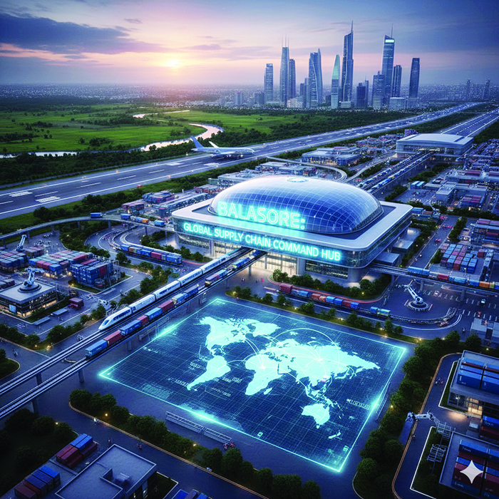
Locating Balasore in the Next Decade Supplychain: Balasore is not drifting into urban expansion. It is being shaped into a logistics machine. Corridor pressure, mineral descent paths, coastal shipping load and sovereign security overlays compress activity inward. What grows is not housing density. What grows is command density. Through the next decade warehousing and distribution land will be absorbed at accelerating speed as freight volumes rise and multimodal parks expand. Inland container depots, cross-docking yards and cold-chain vaults will thicken across the corridor belt. Export tonnage through eastern ports is forecast to rise sharply and inland staging demand will follow. Employment demand will expand across transport, storage, handling, packaging and last-mile services. Defence procurement reforms and industrial corridor programmes will pull calibration, assembly and supply-chain vendors closer to secure movement zones. Defence storage zones, FMCG distribution grids, mineral export staging yards, agro-seafood cold chains and electronics assembly corridors will form as parallel layers. Balasore is moving into the geometry of a national logistics command territory under freight logic and security governance.
Conclusion
Eastern India’s coastal corridor is entering a phase of structural densification rather than linear outward spread. Port throughput, mineral descent volumes and defence-linked logistics loads are compressing into a limited number of inland control basins where cargo can regain order before maritime exit or national redistribution. Balasore is positioned to absorb this pressure as a stabilisation relay that protects movement predictability and corridor governance. What will expand along the eastern coast is not only port capacity but inland command density and protected staging space. The corridor is therefore evolving into a layered logistics system where freight stability, security geography and national supply-chain control consolidate into a new eastern logistics architecture.

Dr. Padmalochan Dash
(The content of this article reflects the views of writer and contributor, not necessarily those of the publisher and editor. All disputes are subject to the exclusive jurisdiction of competent courts and forums in Delhi/New Delhi only)


Leave Your Comment